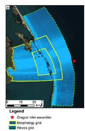
Oregon Inlet is a main channel from the Atlantic Ocean into the inner sounds and communities along the Outer Banks of the North Carolina coast. However, as the inlet evolves, its strong currents can erode the inner marsh and threaten infrastructure including the new Basnight Bridge and NC Highway 12
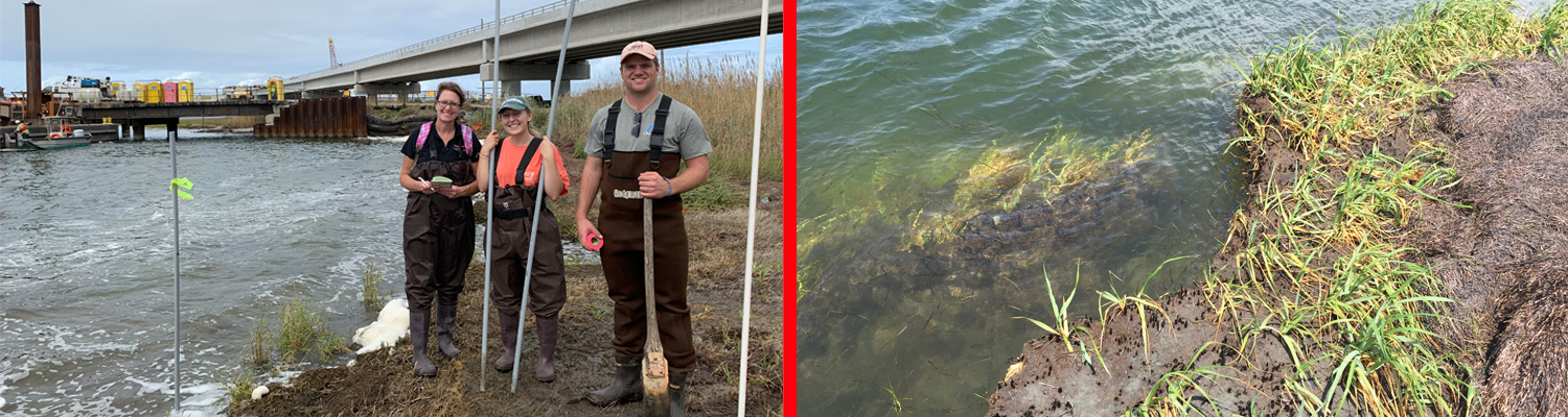
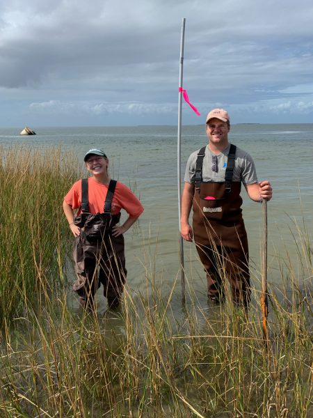
A team led by Dr. Elizabeth Sciaudone, CCEE Research Assistant Professor, began collecting data near Oregon Inlet in mid-October as part of a multi-year research project. They obtained measurements of currents in a tidal inlet channel at Oregon Inlet, as well as assessment of soil and plant characteristics in the marsh at the sound side of Pea Island. Funded by the North Carolina Department of Transportation (NCDOT), the study’s focus is on determining the physical processes that are causing erosion at the marsh.
Researchers will also look at potential mitigation options to halt or reverse the marsh erosion, with a focus on nature-based solutions. In addition to several CCEE undergrad and graduate students, the research team includes faculty and students from the US Naval Academy including CCEE alumna Dr. Lilianna Velasquez-Montoya (Ph.D 2018). This team will join other collaborators, including researchers from Virginia Tech and Louisiana State University that are part of a national nearshore field experiment called DUNEX.
DUNEX, which stands for During Nearshore Event Experiment, is a multi-agency collaborative experiment taking place on the Outer Banks of North Carolina to study nearshore coastal processes during coastal storms. The multi-phase experiment plan begins with a pilot study in fall 2019, followed by the full experiment starting in fall 2020 and extending into winter 2021. By leveraging different expertise and research efforts, DUNEX aims to improve the basic understanding, predictive capabilities, and observational technologies for extreme coastal storm processes and impacts within the coastal environment. DUNEX also aims to improve communication of research findings and data between scientists and the managers of coastal communities.
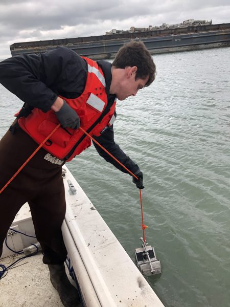
“We will definitely benefit from the collaborative nature of this project,” says Sciaudone. “When we were testing our experimental set-ups, including the boat-mounted current profiler, a student from Virginia Tech who was also working on the Outer Banks as part of the DUNEX pilot joined us on the boat. She used a specialized instrument that looks like a small submarine to test soil properties at different times of the tidal cycle. That student is part of a team led by Dr. Nina Stark, and we will have access to the geotechnical data that her team collects, and will in turn share the current data that we collect. The team from Louisiana State also joined us on-site when we did our pilot work. They are looking at how the marsh plant root mat and different types of soil will affect the shear strength of the soil. With no additional funding, we are able to leverage our work and share data to learn even more about the area.”
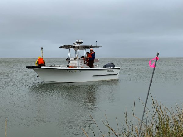
In early November, divers from the NCDOT will place a current meter at the bottom of the channel where it will stay for about three weeks. “This data will give us a preliminary look at what the currents and tides are doing,” Sciaudone said. The team will spend the next few months analyzing the data and making sure that their instrumentation is working properly. “We’ll plug these data into some of our numerical models of water and sediment movement in Oregon Inlet which will allow us to evaluate whether there are areas of particular interest when deploy the equipment next summer.